Products
C-Map
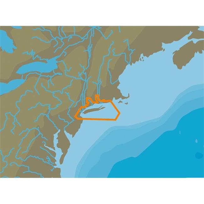
C-map NA-C332C&CARD NT Plus Block Island & Long Island - C Card Format
Upgrade to unlock this product- Shipping Cost (lower 48): $5.10
- SKU: CW69121
- Asin:
- Manufacturer Part #: NA-C332C/CARD
- Qty Available: 1
- Shipped By: 4 days
- Stock: In Stock
Please login to view pricing details.
Product Description
Features
- Global Coverage
- Rich chart detail and available data to aid in safe navigation
- Port & Tide Information
- Frequently updated chart data
- Easy on-screen queries of chart objects for greater situational awareness
- Compatible with many brands and models of chartplotters on the water
- Compatible with PC Planner
- C-MAP NTPlus cartography helped launch a digital charting revolution years ago, and it is still as useful and reliable as ever
- For fishermen, sailors and cruisers who continue to depend on C-MAP NTPlus
- We provide updates twice annually to ensure that navigators benefit from all the latest Coast Guard Notice to Mariner changes and other important chart data updates
- C-MAP NT Plus provides boaters with the accurate, up-to-date vector chart detail Depth Areas and Contours, Spot Soundings, NavAids, Light Sectors, Wrecks / Obstructions, Small Craft Facilities and more
- The detail and information available with C-MAP NT Plus charts lets boaters approach any harbor and inlet with confidence - the perfect conclusion to a long voyage, sailing adventure or exciting day of bluewater fishing
- C-MAP NT Plus Tides feature presents the time, water level and direction of tides with Tide Level graphs. This information is vital for navigation and fishing
- C-Marina Port database and detailed marina charts in C-MAP NT Plus provides useful, categorized information for cruisers, fishermen and sailors - including Port Layout and Facilities, Operating Hours, Accessibility, phone/Email Contact Info and more
- Coverage Area: Block Island & Long Island
- Card Format: C-card
- Weight: 0.3 lbs
 upgrade to unlock this product
SD CARD FORMAT COSTA RICA-CHILE FALKLANDS
upgrade to unlock this product- Western Caribbean Sea - C-Card
upgrade to unlock this productNA-C603 - Hawaiian Islands - C-Card
upgrade to unlock this productNA-C702 - Nanoose To Victoria To Cape Scott - C-Card
upgrade to unlock this product- Western Caribbean Sea - FP Card
upgrade to unlock this product