Products
National Geographic
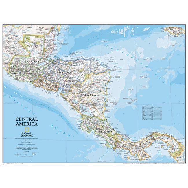
National Geographic RE00620011 Map Of Central America
Upgrade to unlock this product- Shipping Cost (lower 48): $15.15
- SKU: NGS297
- Asin: B018REHESG
- Manufacturer Part #: RE00620011
- Qty Available: 677
- Shipped By: 4 days
- Stock: In Stock
Please login to view pricing details.
Product Description
National Geographics detailed political wall map of Central America takes an up-close look at the countries of this region. Markings include political boundaries place names rivers and waterways major highways and roads parks and preserves and more. Features: Detailed political markings Major highways Map Scale 1in equals 40 miles Overall Dimensions 22in H x 29in W
 upgrade to unlock this product
Raised Relief Map K-SF2225 San Francisco Bay
upgrade to unlock this productRaised Relief Map 419 Yellowstone National Park
upgrade to unlock this product434 World Geo-Physical Map
upgrade to unlock this product436 Ocean Floor Map
upgrade to unlock this productProducts 448 Middle East Map
upgrade to unlock this product